Challenge(s)
What actions should be taken to tackle the issue of rising sea levels and the risk of coastal flooding?
Good practice
Combine infrastructure with the functions of nature
Originally, port cities were founded in commercially strategic locations without taking into account environmental considerations. Studies of climate change and rising sea levels have highlighted the vulnerability of coastal areas and many port cities around the world. Waterfront areas and those where cities and ports meet are at particular risk and can serve as testing grounds for resilience strategies inspired by natural functions. Combining infrastructures and natural functions is clever and important in this situation. In Boston, stakeholders collaborate on a project to mitigate the effects of climate change and the risk of flooding in the city's urban spaces.
This good practice also includes objective 1.5 (Making resilience and carbon neutrality a priority in the design and operation of Port City installations with the use of the latest technologies in emissions reduction and CO2 capture/storage) of the AIVP's 2030 Agenda.
Case study
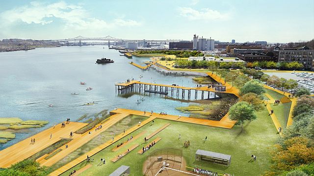
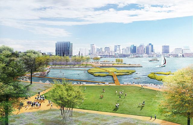
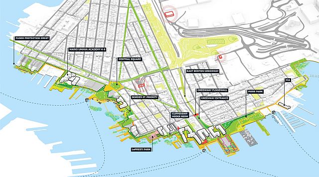
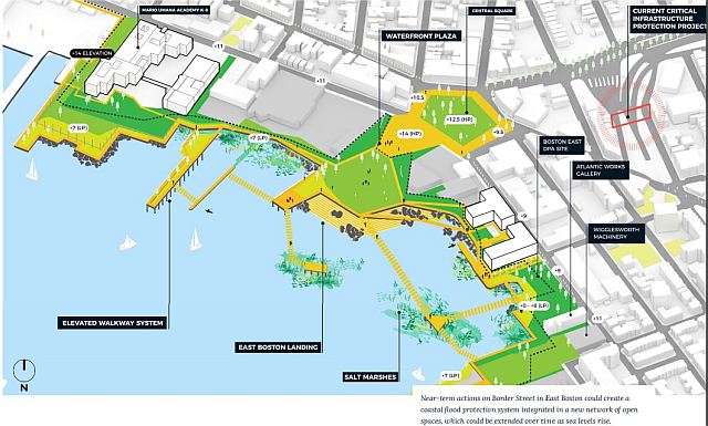
In 2015, the City of Boston organised “Living with water”, an ideas competition looking ahead to 2100, focusing on three specific sites. The three winners were named in June 2015. The Climate Ready Boston report, carried out in 2016, predicted that sea levels could rise by 9 inches (22.86 cm) by 2030 as compared with their 2000 levels, by 21 inches (53.34 cm) by 2050, and by 36 inches (91.44 cm) by 2070. After that, in October 2017, the city unveiled an action plan to tackle the problem and provide short and long-term protection for the waterfront areas most at risk, including the heavily populated districts of East Boston and Charlestown. In these two sectors, a nine-inch rise in sea levels would increase the current 1% annual flood risk to 4 or 5%. Proposed solutions include creating public spaces to improve the permeable land area or raising the level of roads, parks, squares and promenades. The measures would also help mitigate other effects of climate change, such as heavy rain or extreme heat. In addition, the plan represents an opportunity to restore access to the waterfront, which would be used for social and leisure activities while offering views of the port. A movable barrier could be constructed as a short-term solution, such as a large levee at the port of Boston. A cost-benefit analysis has been carried out as part of the plan, and a calendar of the various short and long-term measures has been put together. The local community has been widely consulted on the project: residents, associations, interest groups, public sector bodies (city departments, regional and national agencies), non-profit organisations, private landowners, etc.
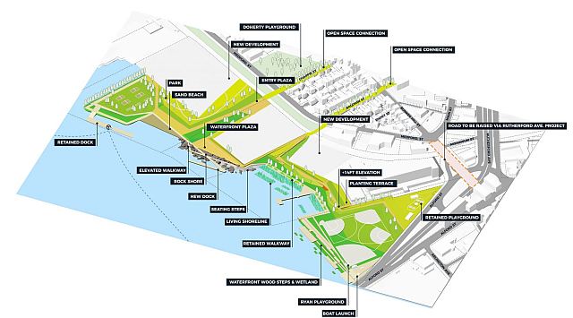
Another report concerning the Downtown Boston and North End areas was released in September 2020. The report brings a vision for the future of the Downtown and North End coastline that reduces coastal flood risk, improves connectivity and accessibility, and enhances recreation and public amenities along the Harborwalk. Also, in 2020, the Langone Park and Puopolo Playground project opened in the area. It was the first park system to integrate the standards set forth by the City of Boston’s Climate Resilient Design Standards. The project elevates the park by 2 meters with ground improvements, micro piles, and lightweight soils. It ensures no harm to nearby structures and includes stormwater and infrastructure protection strategies for faster post-storm recovery. In 2022, the second phase report for Charlestown and East Boston was published, showing the continuity of the initiative. It is important to highlight the strong communication of the project; on the “Climate Ready Boston” website, it is possible to find all publications as well as a project tracker with steps and an interactive map of ongoing projects. This approach is aligned with the 2016 report strategy of educating and engaging citizens on climate hazards and action.
Additional information
https://www.boston.gov/sites/default/files/file/2023/03/2016_climate_ready_boston_report.pdf
https://www.boston.gov/news/now-open-langone-park-and-puopolo-playground-north-end
https://drive.google.com/file/d/1iCqRC4GGlkuBJYLFc7P95MyZRHnK2iOS/view
https://www.boston.gov/departments/environment/climate-ready-boston/coastal-resilience-east-boston
https://www.boston.gov/departments/environment/climate-ready-boston/coastal-resilience-charlestown
https://boston.maps.arcgis.com/apps/Cascade/index.html?appid=c438a8a66e9d470b8b305a973fc192f7
https://www.boston.gov/environment-and-energy/climate-ready-boston
In images