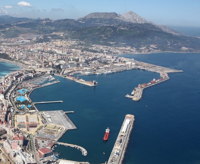
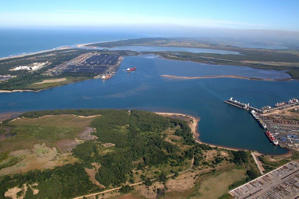
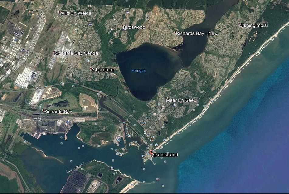
The Port City of uMhlathuze (Richards Bay) is a City in the Republic of South Africa situated on the north-east coast of the Province of KwaZulu-Natal, about 180 kilometers north-east of Durban. The uMhlathuze land area covers 79 334 Ha to 123 325 Ha and incorporates Richards Bay, Empangeni, eSikhaleni, Ngwelezane, eNseleni, Felixton ,Vulindlela, Bhuchanana and Heatonville and a coastline that spans approximately 45 kilometers. The N2 highway traverses the City of uMhlathuze in a north-east direction towards the Swaziland border and south-west towards Durban. It effectively forms a division between Empangeni and Richards Bay.
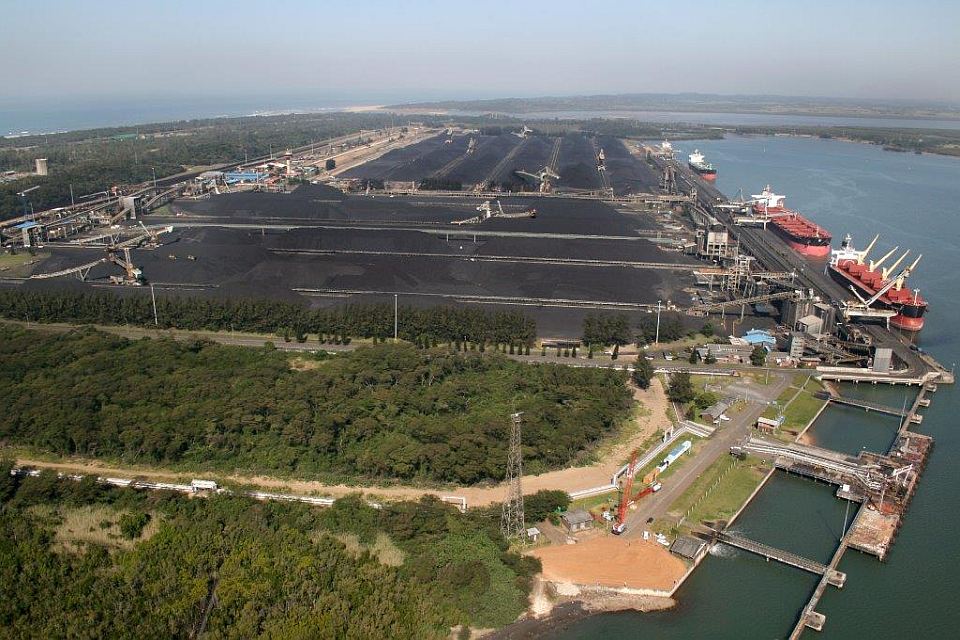
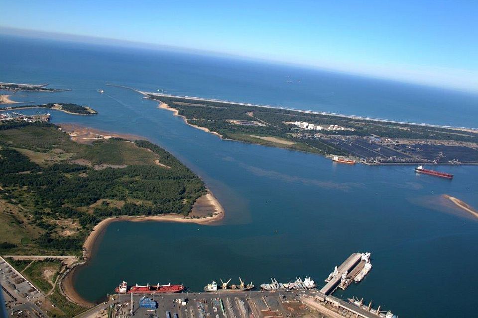
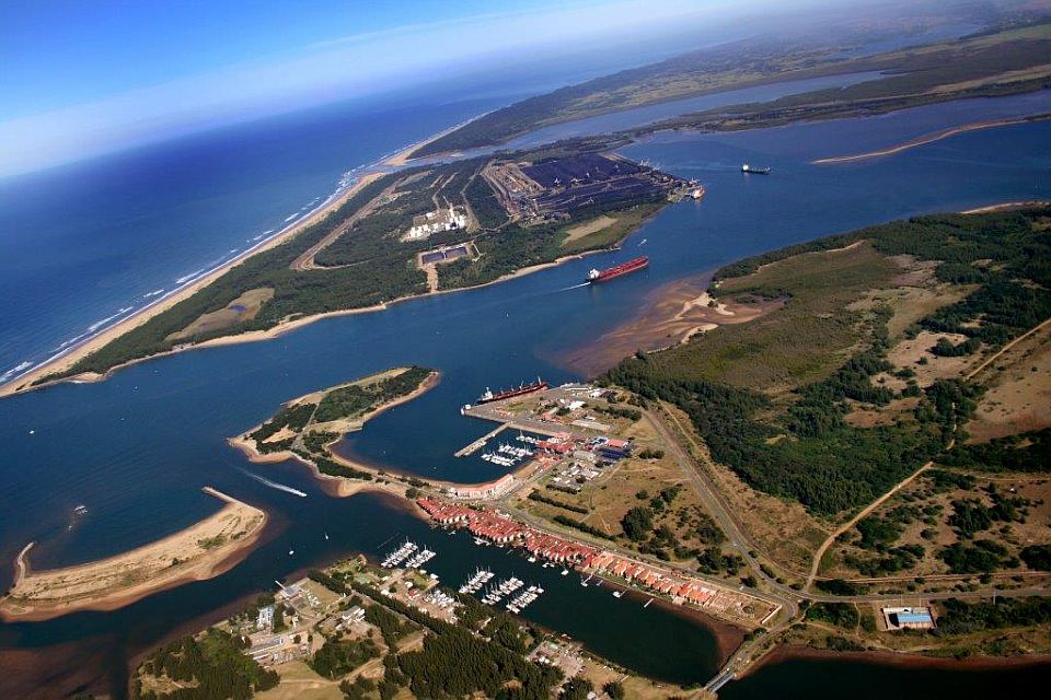
There are a number of natural and man-made phenomenons that have shaped and continue to shape the City of uMhlathuze. The area is inundated with a system of wetlands and natural water features. The main access into the City area is via the N2 in a north south direction. The City has the benefit of about 45km of coastline of which about 80% is in its natural state. The City hosts the Richards Bay Deep-Water Port and Richards Bay Industrial Development Zone.
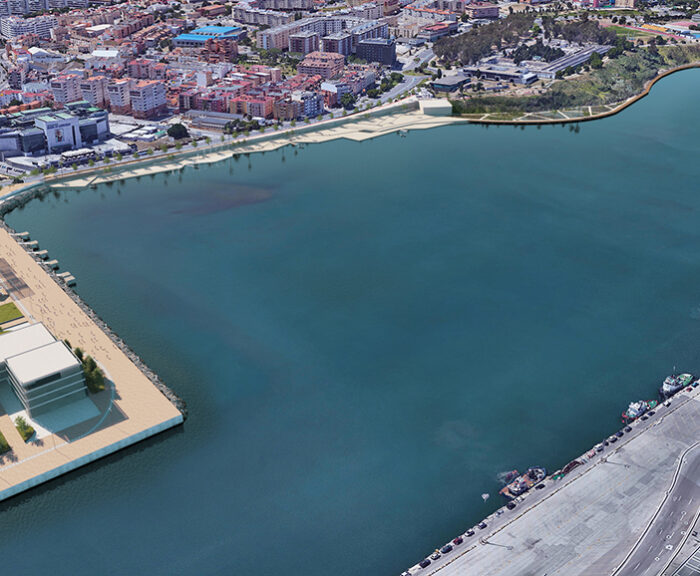
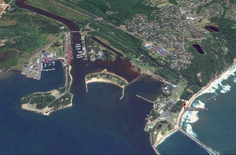
The uMhlathuze Municipality undertook the development of an Urban Design Concept for the Alkantstrand Beach Precinct area aimed at developing a theme and vision for the area that could correlate with the larger waterfront area.
In summary, the project motivation to develop an Urban Design Concept for the Alkantstrand Beach Precinct that ensures it is:
- Mutually resilient from coastal erosion
- Aesthetically appealing
- Economically stimulating
- Iconic in status and acts as a tourism catalyst
The Urban Design Concepts responds to the anatomy of the beachfront in the following manner:
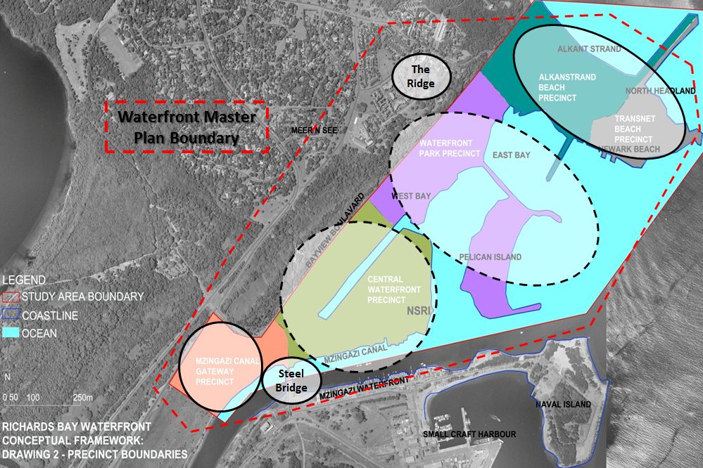
The following phased implementation programme has prepared for the Alkantstrand/Newark Beach area. This must be read in conjunction with the concept and phasing plan.
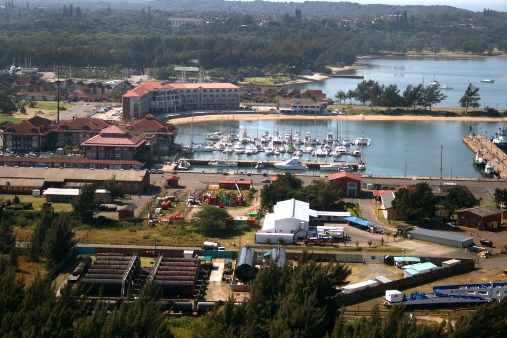
Richards Bay Waterfront
Phase 1: Preparation for Implementation (Planning and Detailed Design)
1.1 Initial stakeholder engagement
1.2 Land legal procedures and acquisition of key properties
1.3 Preparation of detailed precinct plan
1.4 Engagement with possible investors and business partners
1.5 Marketing of Alkantstrand Beach Precinct
1.6 Determine latest, most accurate coastal setback lines
1.7 Negotiate appropriate sand bypass procedure with Transnet (timing and volumes)
1.8 EIA process and associated environmental consents (e.g. Water use license and ICMA permits and authorisations)
Phase 2: Establishing the Main Structure
2.1 Ocean Ridge Road re-alignment and upgrade
2.2 Alkantstrand Beach Square
2.3 Development of Mini Sports Precinct
2.4 Construction of Precinct Management Centre
2.5 Development of Kids Play Area
Phase 3: Securing the Ecological Infrastructure
3.1 Implementation of Rapid Erosion Mitigation Measures
3.2 Rehabilitation of Dune vegetation
3.3 Phasing out of alien species and replacement with indigenous tree and dune species
3.4 Development Beachfront Boardwalk
Phase 4: Unlocking Investment Opportunity
4.1 Market Release of Office and Mixed-use sites
4.2 Development of Promenade (Phase 1)
4.3 Cultural Centre
Phase 5: Establishment of Iconic Nature
5.1 Construction of Outdoor Amphitheatre
5.2 Development of Feature Restaurant and Lifeguard Building